01 / FASTER
Faster Iteration
Preview scenarios, compare options, and refine designs without long recalculation times.
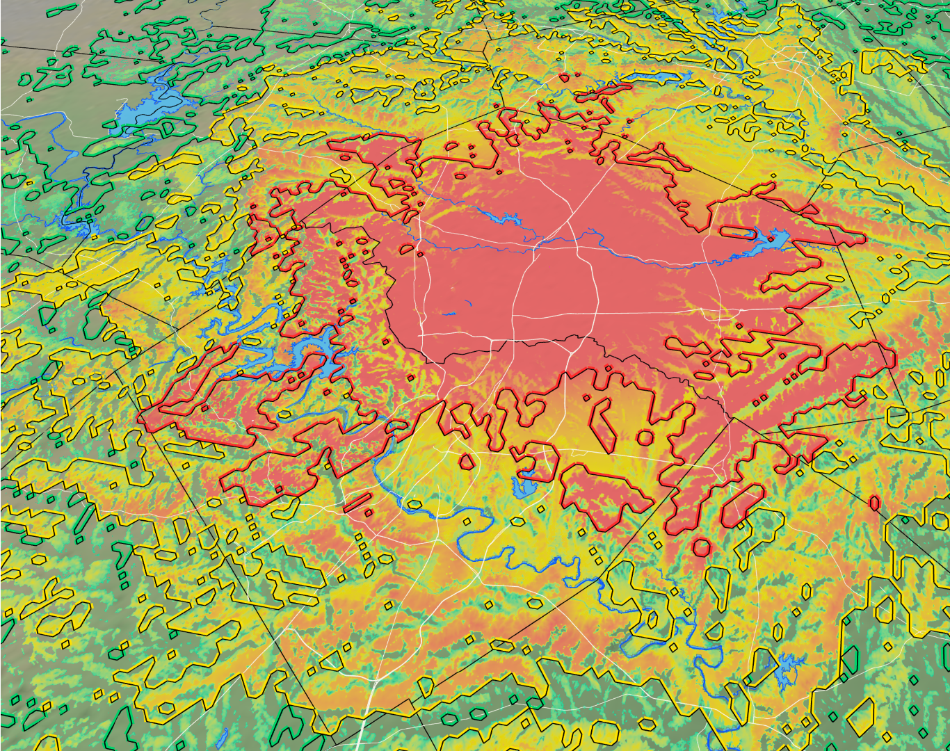
The next generation of geospatial and RF propagation visualization
RF Projector combines proven propagation models with modern visualization and ultra fast analysis. Build your transmitter sites in the platform and quickly visualize coverage results against surrounding terrain in real time.
How it comes togetherRepresentative capabilities for planning, analysis, and technical review.
Preview scenarios, compare options, and refine designs without long recalculation times.
Share interactive maps, comparisons, and polished exports with technical and non-technical stakeholders alike.
Validate against reference models, document assumptions and limitations, and preserve report data.
Manage analysis, mapping, and reporting in one organized project portfolio.
Powerful controls for RF professionals with easy to understand workflows for new users.
RF Projector is designed around the way RF engineers actually work: start with your area of interest, build transmitter sites and study the coverage results.
Center the map on your area of interest, set the study grid size and choose a terrain model.
Configure one or more signal sources, then compare their coverage overlap, and predicted signal strength against the terrain model.
Move from coverage to profiles and contours, then export a map-ready result for presentation or export to third part software such as Google Earth.
Speed up your workflow without giving up familiar tools.
Bring your next site, coverage question, or propagation study into focus.
Request a demo